
A6 Portable GPS for hiking, multi-gnss support, light …
$116.99
Description
Price: $116.99
(as of Jul 18, 2025 22:05:56 UTC – Details)

Product description

How to use the position, track and navigation function?
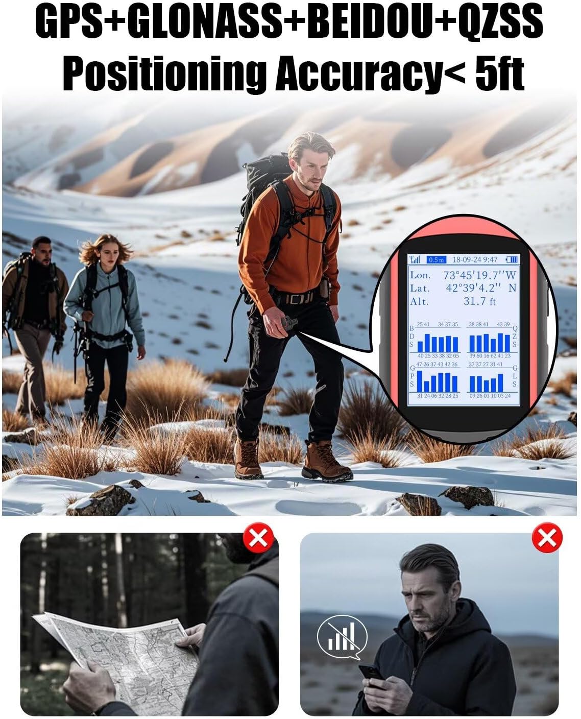
– All methods should be used outdoors and the value of the signal must be <1m before using!
The video shows the product in use. The video guides it through product configuration. The video compares multiple products. The video shows the product that is being unpacked. 4 WayPoint Function Commercial Video
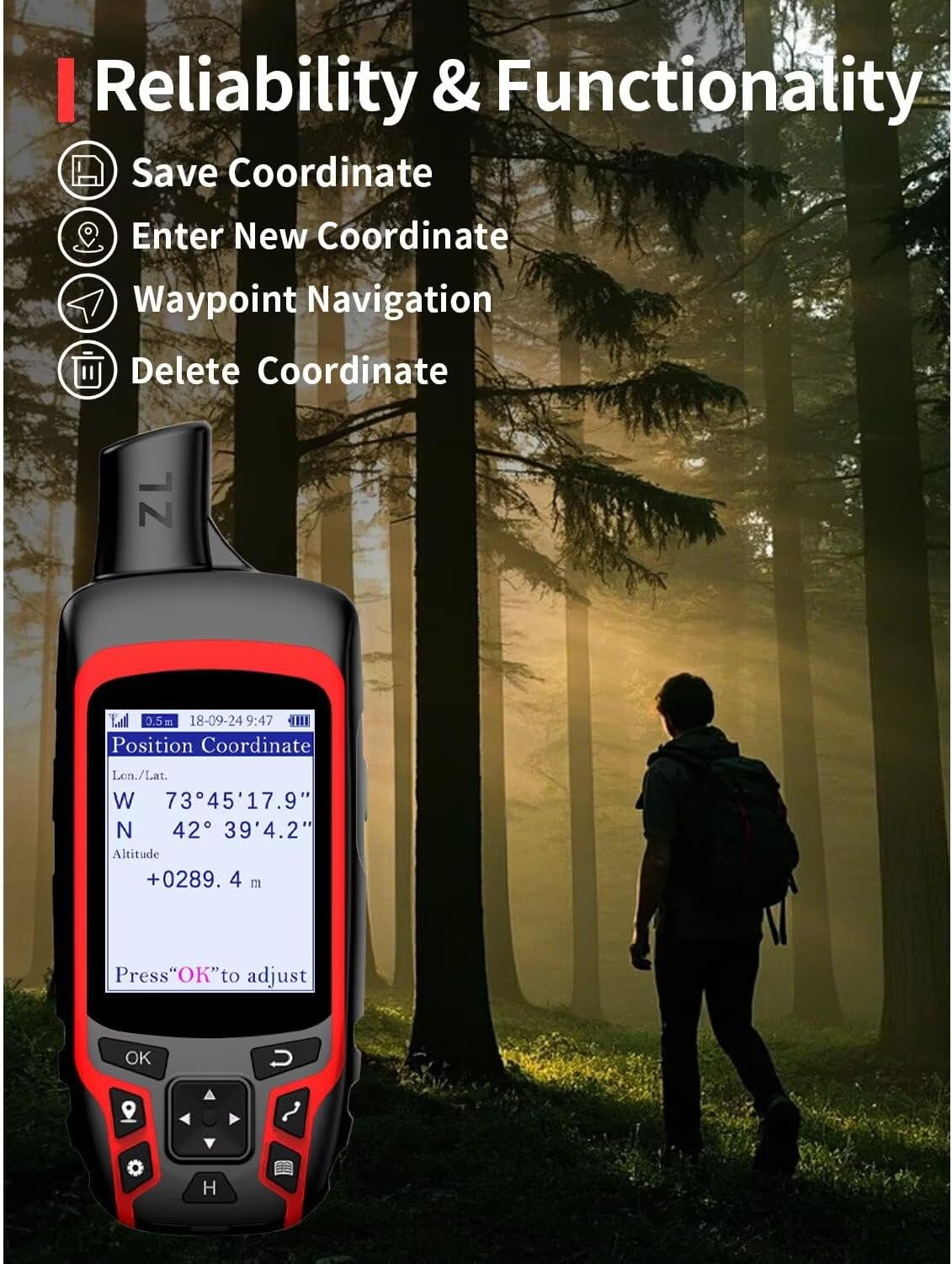
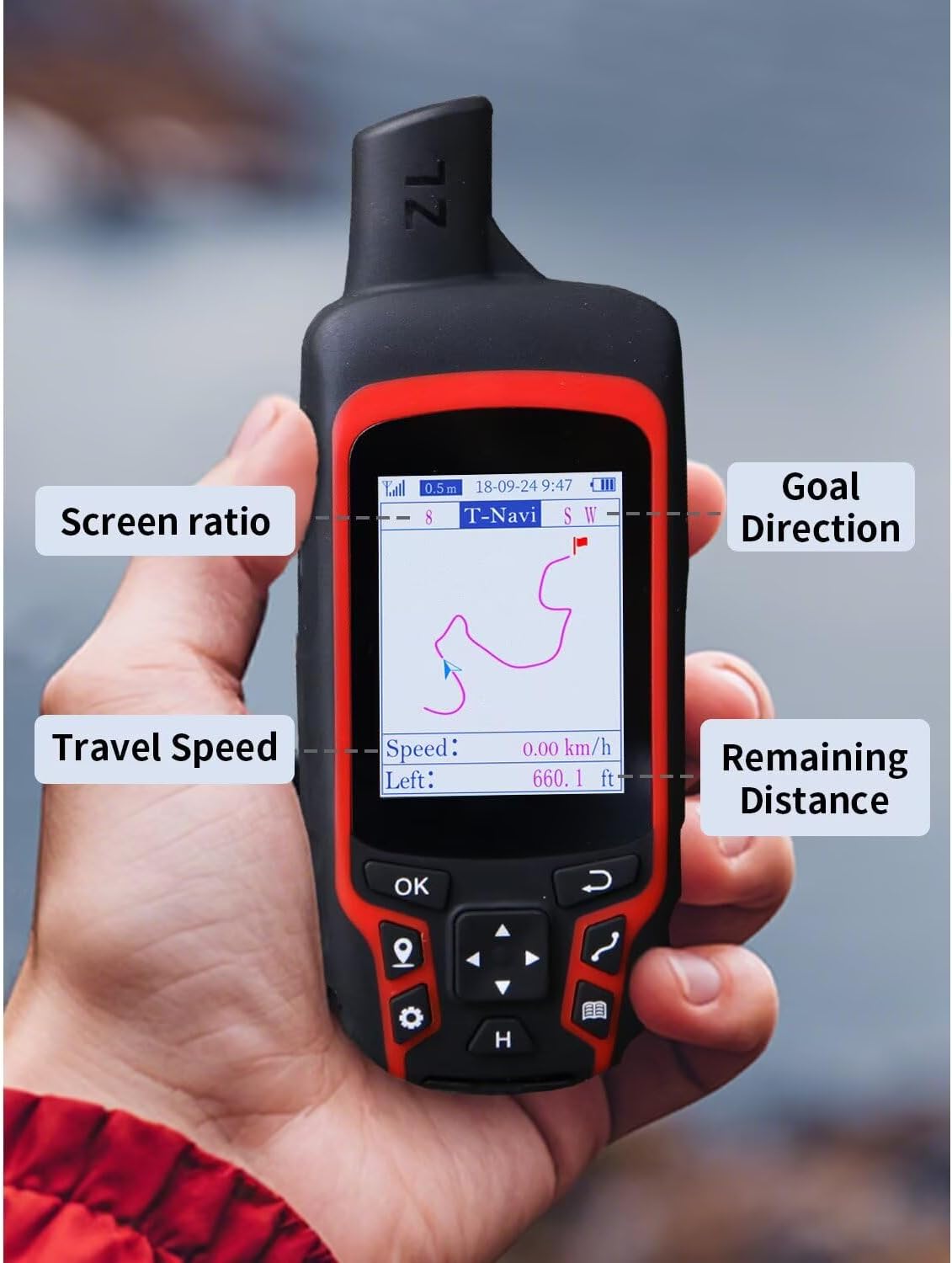
4 WayPoint functions
Save current GPS coordinates / Enter known coordinates / Navigate to coordinates / verify and eliminate coordinates.
You must save a position coordinate before using the position navigation function
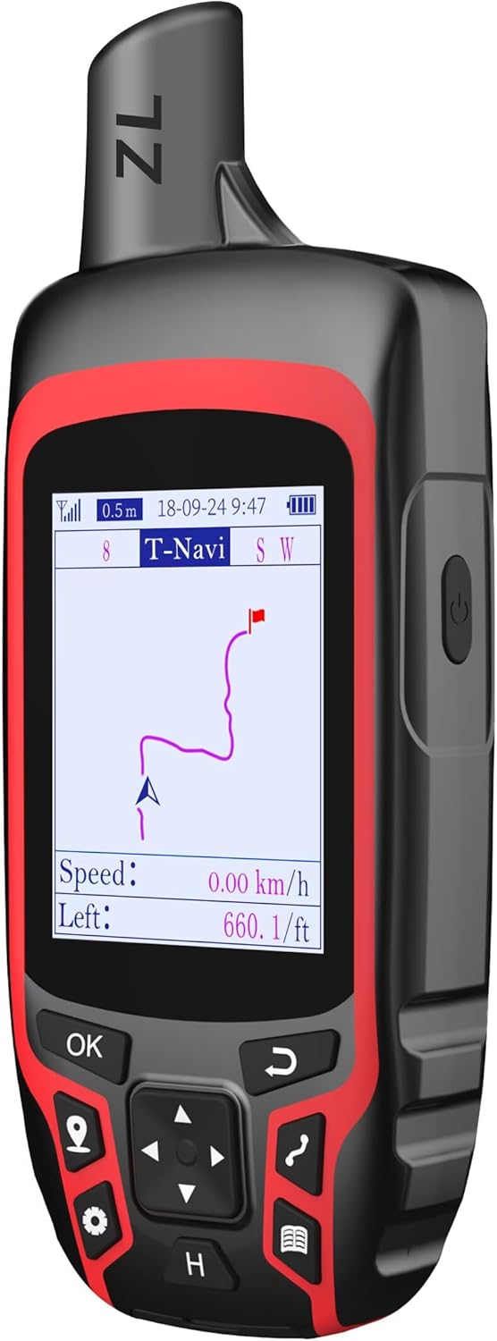
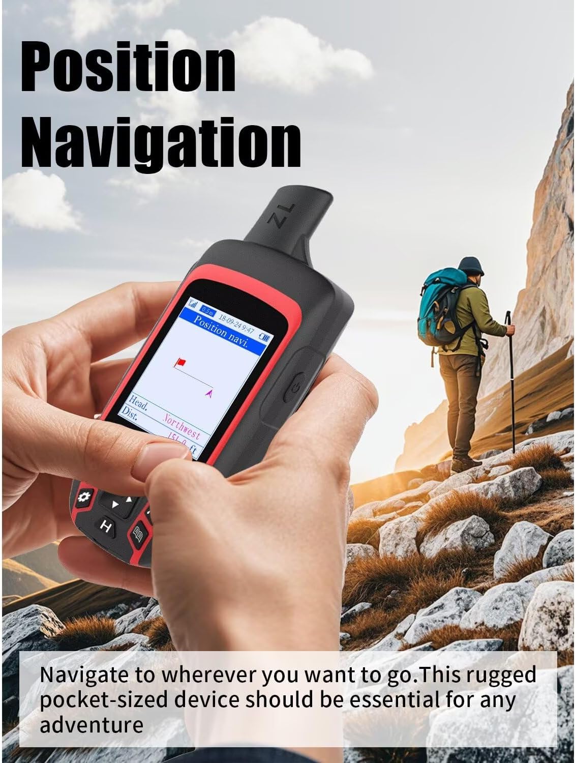
Navigation
Using this method when traveling to a network without a road or a wide area of easy -to -get perdition, can help you return from the original route to the starting point.
You need to record your career at the beginning of the walk.
The video shows the product in use. The video guides it through product configuration. The video compares multiple products. The video shows the product that is being unpacked. How to track the measure of the commercial navigation video area
Support the automatic track area and measurement of the area of collected points. You can use this method to measure the area of several lands, such as mountains, inclined fields, ranches, farmland, football and garden. First of all, look for satellite signals in an open exterior area before using this device, there is no signal to search inside. When the signal value in the upper left corner of the machine screen is less than 1 m, begin to use it to guarantee the accuracy of the machine
The video shows the product in use. The video guides it through product configuration. The video compares multiple products. The video shows the product that is being unpacked. How to measure the area of video merchant from the area
Support the distance from the automatic track and the measurement of the distance of the selection points. You can use this method to measure the length, such as the length of cultivation land fences, off -road routes, house limits, golf courses, etc. When the signal value in the upper left corner of the machine screen is less than 1 m, begin to use it to guarantee the accuracy of the machine
The video shows the product in use. The video guides it through product configuration. The video compares multiple products. The video shows the product that is being unpacked. How to measure the commercial video distance


1 DECLACE COLOR 2 RECARGABLE BATTER 3 IP65 WATERY 4 Post -sales commitment


What should I pay attention to before using the product?
Look for satellite signals in an open outdoor area before using the machine. When the signal value in the upper left corner of the machine screen is below 1 m, start using to guarantee the accuracy of the machine.
Does this product have a map?
No, this device has no maps.
How precise are your position monitoring?
3.2 feet ~ 6.5 feet.
Can specific navigation coordinates enter?
Yes, you can manually enter a coordinate.
Product dimensions: 6.1 x 0.9 x 2.1 inches; 8 ounces
Element model number: A6
Date for the first time: October 10, 2024
Manufacturer: Niesahyan
ASIN: B0DJS6RC4N
Customer reviews: 3.2 3.2 of 5 stars 17 classifications P.When ('A', 'Ready'). Execute (Function (a) {If (dpacrhasregisteredclinkClickaction! == True) {dpacrhasregisteredarclinkclickaction = True; A.Declarative ('Acrlink-Click-Mick-Mects', 'Click', {“dismissing”: True}, function (Event) {{if (winwaw. {) ue.count (“acrlinkclickcount”, (ue.count (“acrlinkclickcount”) || 0) + 1); 'Click', {“Descetinelinkdefault”: True}, Function (Event) {If (Window.ue) {ue.count (“AcaterslinkwithPopoverclickCunt”, (EU
High precision: Access 4 global navigation satellite systems (GPS+GLASSS+BEIDOU+QZSS) To improve the accuracy of the position, especially in challenging terrain or areas with weak signals, position precision < 5 feet
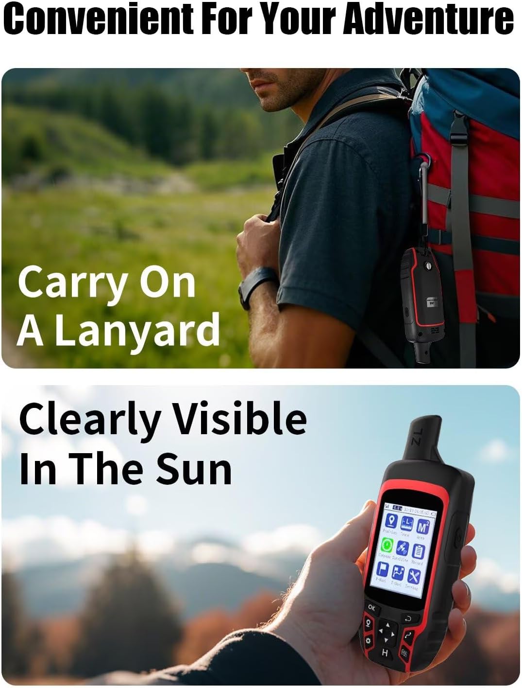
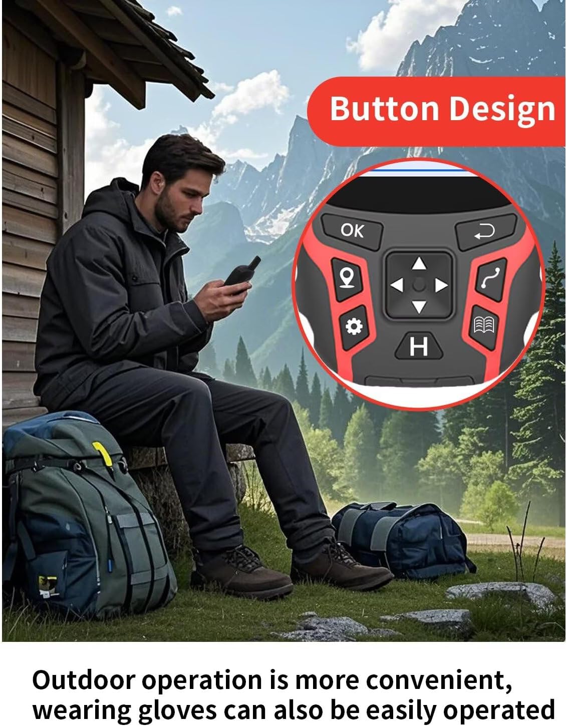
Display: Legible color screen of 2.4 inches for sunlight for easy visualization, you can see the navigation interface clearly even at night, also equipped with a design operated by buttons and non -sliding
4 Reference point function: Save current GPS coordinates, enter known coordinates and navigate to coordinates, eliminate coordinates, you can save 1000 reference points
Trade navigation: record your tracks before walking, you can return to your initial position when you lost the address and store the reference points along a track, the most reliable partner for your outdoor adventure
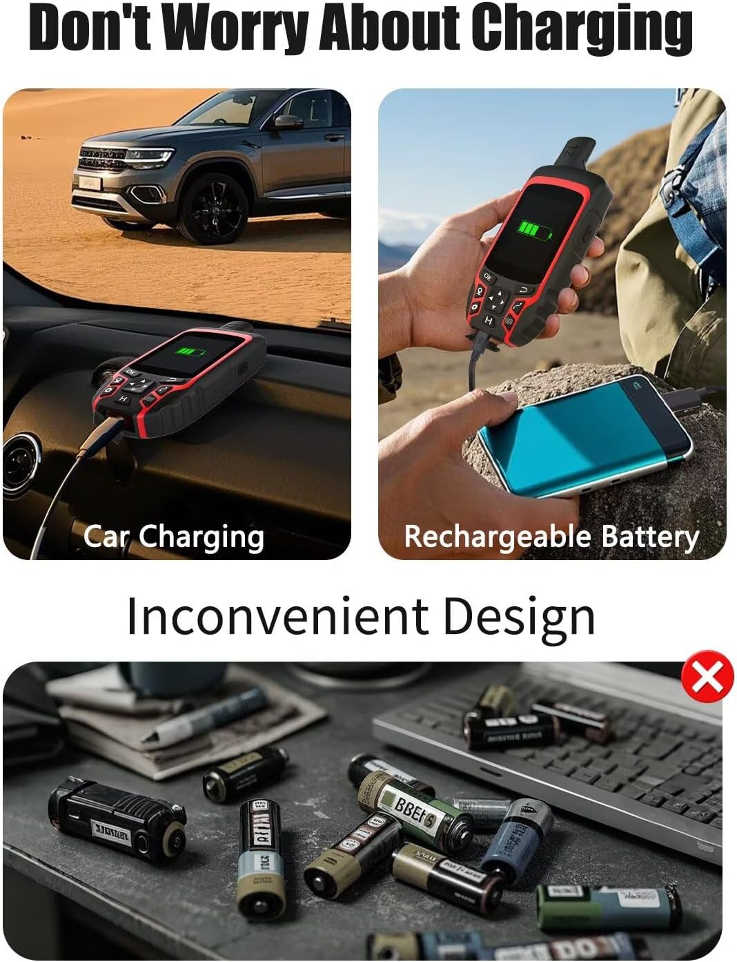
Multiple load methods: fed by an internal rechargeable battery of lithium ions, a 3500 mAh battery lasts up to 20 hours in navigation mode, support energy bank, car cart, USB load, etc.
What you get: 1x GPS A6, user manual 1x, 1x load cable, 1x load adapter, 1x hand strap. This device has no maps
How to use: look for satellite signals in an open outdoor area before using the machine. When the signal value in the upper left corner of the machine screen is below 1 m, start using to guarantee the machine accuracy
Related products
-


Fujifilm Instax Mini 11 Camera with Fujifilm Instant Mini Fi…
$142.95 Buy Now -
 Sale!
Sale!

SAMSUNG Galaxy Tab A9+ 11” 64GB Android tablet, great S…
Original price was: $219.99.$169.99Current price is: $169.99. Buy Now -
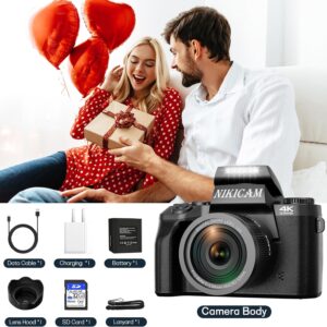

Digital Camera, 4k Cameras for Photography, 64MP WiFi Vloggi…
$159.99 Buy Now -
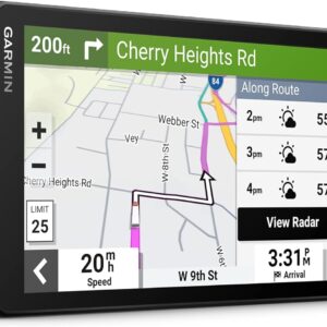

Garmin dēzl OTR710, large and easy-to-read 7” truck GPS navigator…
$449.99 Buy Now
Reviews
There are no reviews yet.